RIAN Products
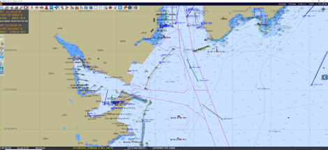
S-100 Badaro ECDIS
주변 선박의 항해정보를 전자해도상에 표시하여 주는 안전 항해시스템
Navigation Information Display System for Surrounding Vessels on Electronic Navigational Charts
Badaro ECDIS
"A company leading the future of the ocean with AI"
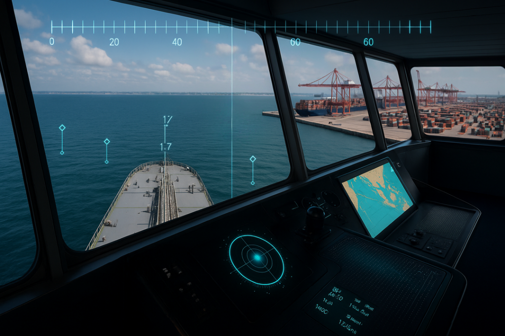
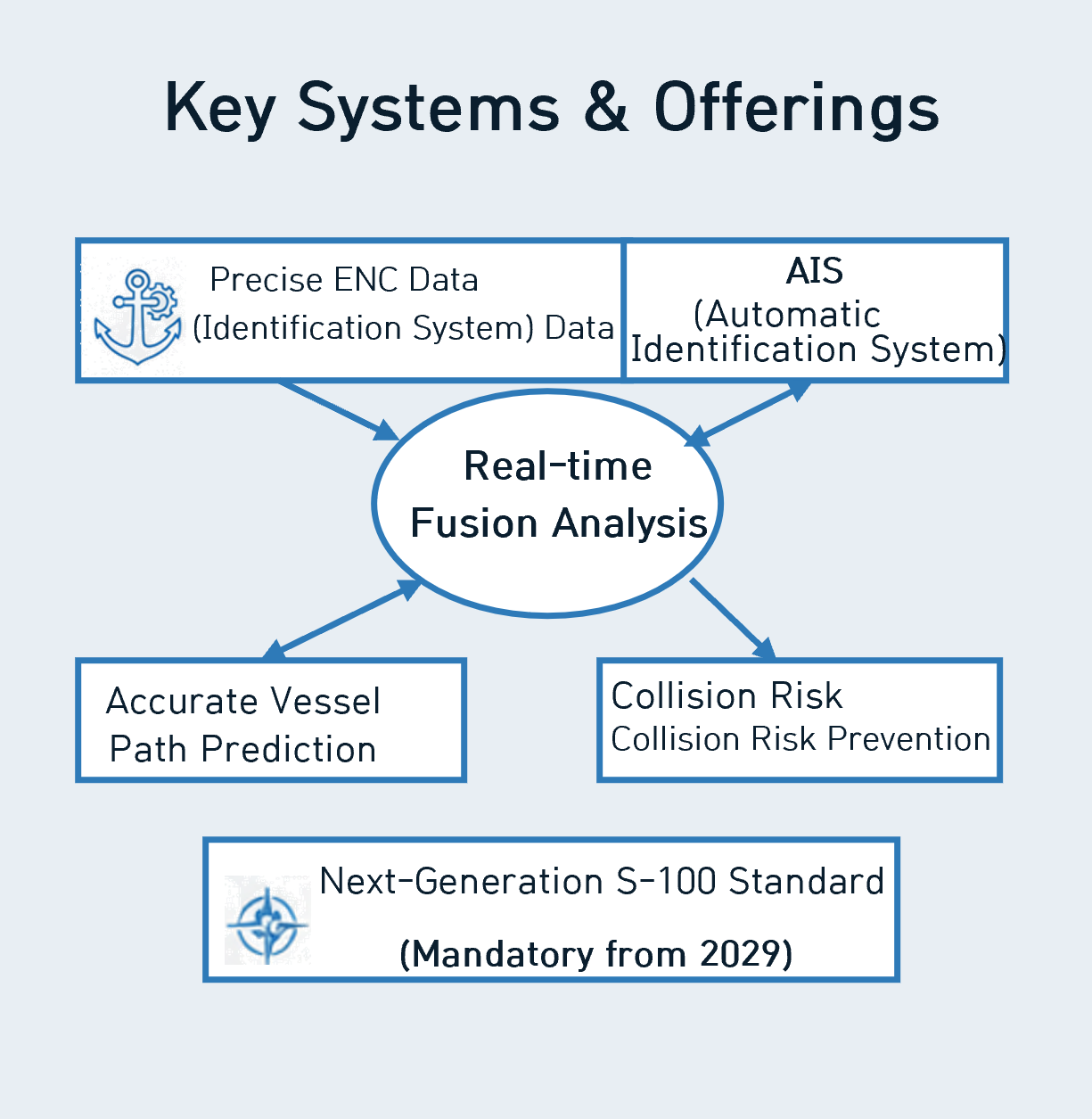
RIAN is a specialized maritime mobility solutions company, setting new standards in maritime safety through advanced ICT. We provide an intelligent vessel traffic control system that performs real-time fusion analysis of precision Electronic Navigational Chart (ENC) and AIS data to accurately predict vessel routes and prevent collision risks. Notably, we have proactively developed a solution fully compliant with the next-generation S-100 standard, which becomes mandatory from 2029, positioning us to deliver richer and more dynamic maritime information. Rian is poised to lead the transformation into the upcoming era of digital navigation, establishing itself as the premier technology partner for pioneering the safest and most efficient sea routes.
Leading the Digital Navigation Era
Specialized in Advanced ICT-based Maritime Mobility Solutions
Core Value

- Advanced ICT Foundation
- Maritime Safety Solutions
Key Systems & Offerings
Future Vision

- Digital Navigation Leadership
- Most Safe & Efficient Sea Routes
Pioneering the Next Generation of Maritime Mobility
with the IHO S-100 Standard
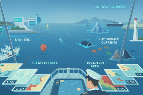
International Hydrographic Organization (IHO): S-101 ~ S-199
S-101
Electronic Navigational Chart
전자해도
S-102
Bathymetric Surface
수심측량 표면
S-104
Water Level Information
수위 정보
S-111
Surface Currents
표면 해류
S-121
Maritime Limits & Boundaries
해양 경계 및 한계
S-122
Marine Protected Areas
해양보호구역
S-123
Radio Services
무선 서비스
S-124
Navigational Warnings
항행 경보
S-125
Marine Navigational Services
해양 항행 서비스
S-126
Marine Physical Environment
해양 물리 환경
S-127
Traffic Management
교통 관리
S-128
Catalogue of Nautical Products
해도 제품 목록
S-129
Under Keel Clearance Management
선저여유수심 관리
S-130
Composite Boundaries
복합 경계
S-131
Harbour Infrastructure
항만 인프라
Pilot Support System
Receiving and displaying vessel positions from AIS on the electronic chart.
Provides port arrival and departure information for maritime pilots.
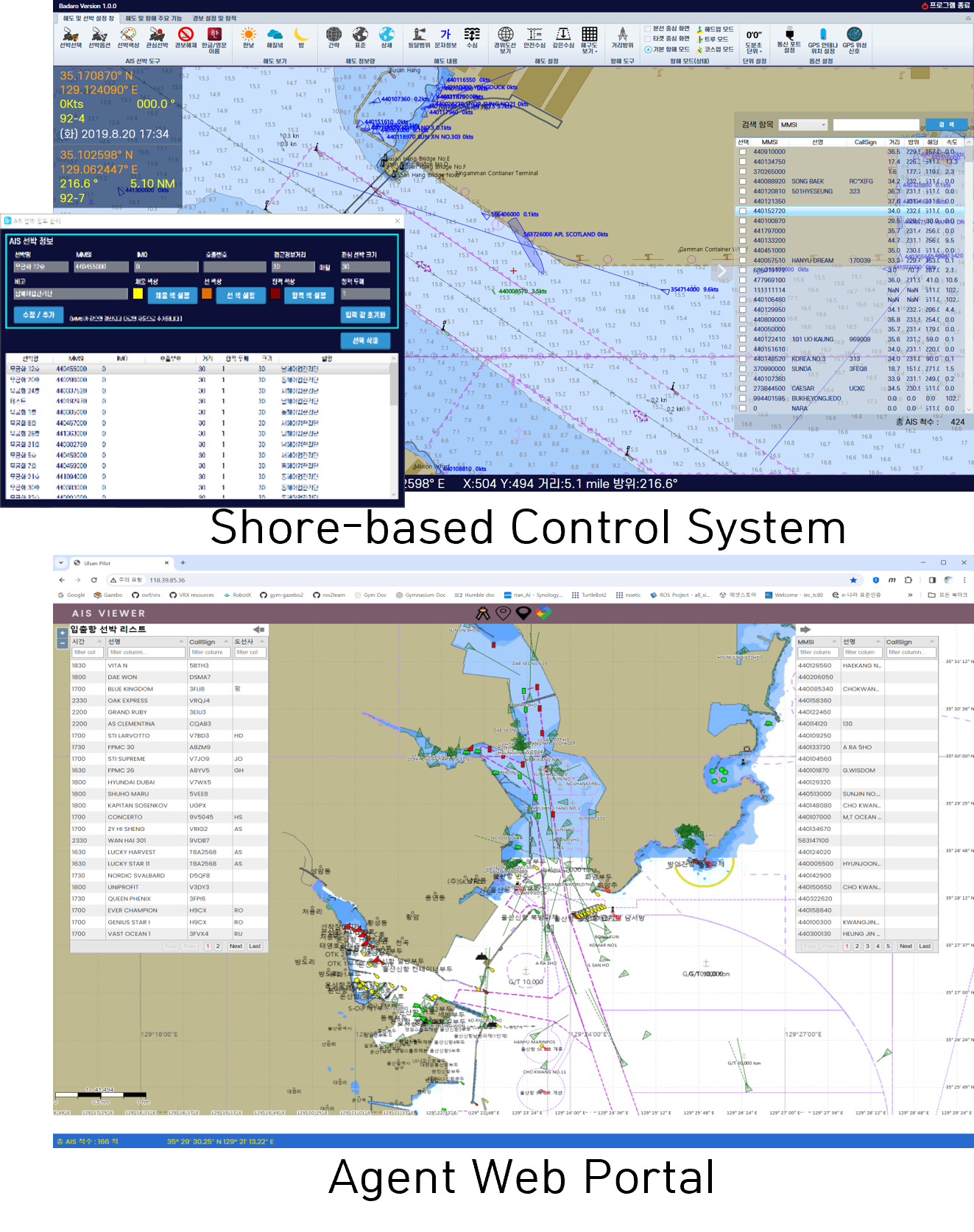
Pilot App | Control Center App | Agent App Pilotage Operations Support
AI Illegal Fishing Detection System
- AIS Information Display
- Integrated Video Display (Body Cam, Surface/Aerial Drones)
- AI-Powered Autonomous Navigation
- AI Piracy & Terrorism Detection
- Real-Time Command Communication
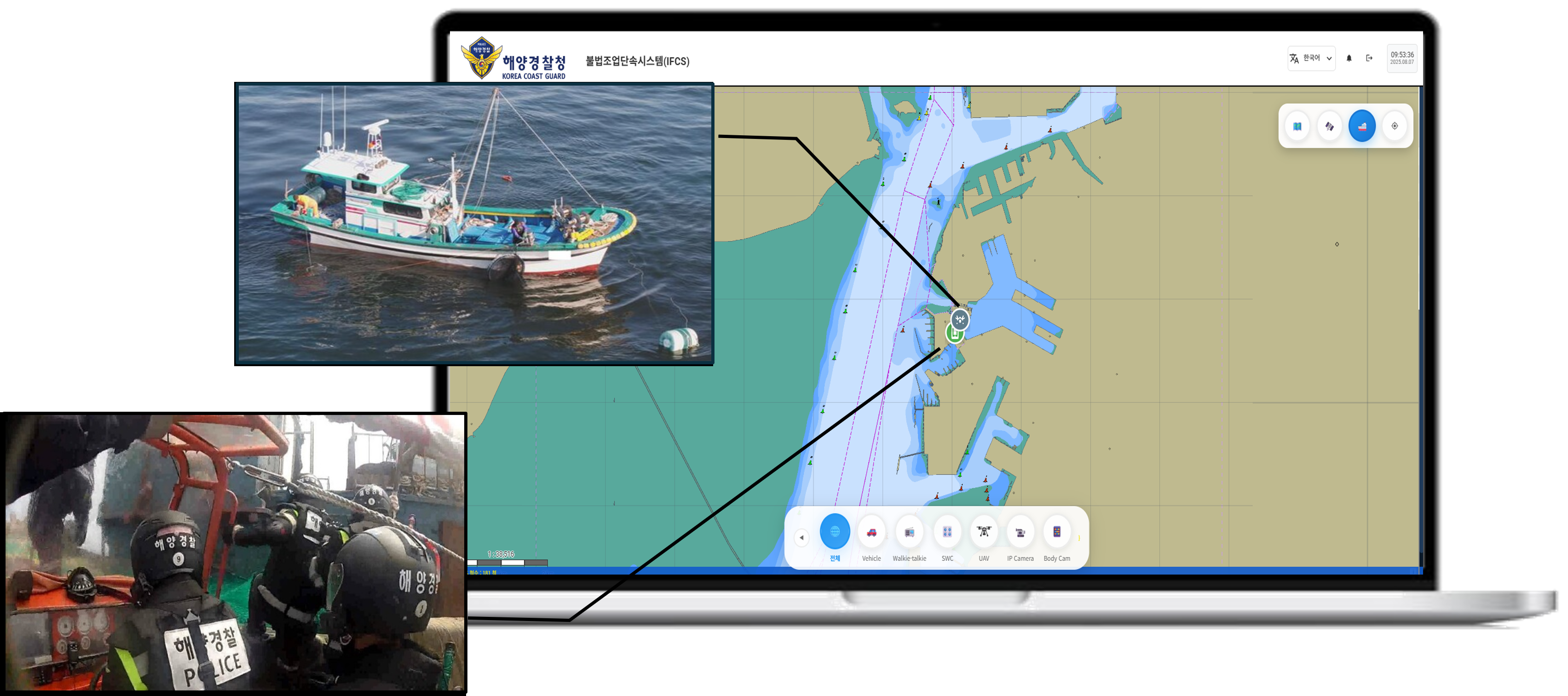
Integrated Maritime Enforcement Platform Combining AIS vessel tracking, body cameras, and surface/aerial drones with electronic navigation charts for illegal fishing detection
AMRD Fishing Net Tracking Device
- RIAN 'BADARO' SW : Fishing Net Position Display Operating on Electronic Navigation Chart-based MFD (Multi Function Display)
- AMRD (Autonomous Maritime Radio Devices) Receiver Transmits fishing net positions via serial communication port and Bluetooth, enabling position verification on display devices and smartphones.
- Ultra-compact, 10 km transmission range, continuous battery charging system, 3-month operation per single charge
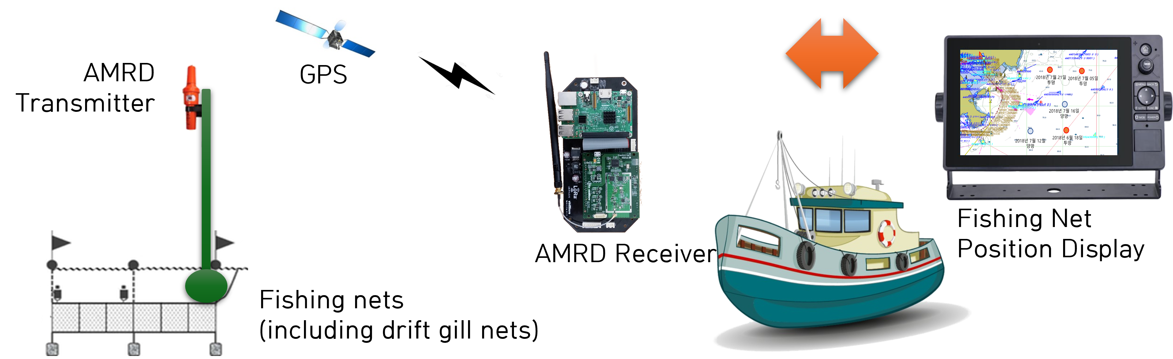
Fishing Net Management System Transmitting net positions from buoys to display devices